 Live Music Archive
 Librivox Free Audio
 Metropolitan Museum
 Cleveland Museum of Art
 Internet Arcade
 Console Living Room
 Books to Borrow
 Open Library
 TV News
 Understanding 9/11
tv CNN Newsroom CNN May 19, 2013 5:00pm-6:00pm EDT
5:00 pm

she got a parking ticket... ♪ and she forgot to pay her credit card bill on time. good thing she's got the citi simplicity card. it doesn't charge late fees or a penalty rate. ever. as in never ever. now about that parking ticket. [ grunting ] [ male announcer ] the citi simplicity card is the only card that never has late fees, a penalty rate, or an annual fee, ever. go to citi.com/simplicity to apply. we're not in london, are we? no. why? apparently my debit card is. what? i know. don't worry, we have cancelled your old card. great. thank you. in addition to us monitoring your accounts for unusual activity, you could also set up free account alerts. okay. [ female announcer ] at wells fargo we're working around the clock to help protect your money and financial information. here's your temporary card. welcome back. how was london? [ female announcer ] when people talk, great things happen.
5:01 pm

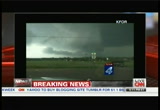
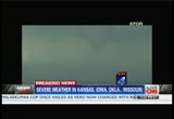
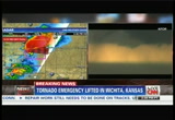
welcome back to the "cnn newsroom." i'm fredricka whitfield. we're watching a severe whether situation right now. we have heard that an emergency situation has been declared, emergency tornado warning declared for wichita, kansas, which means at least one tornado is on the ground. it means that everyone is being urged to take cover. stay in a safe place. our jennifer delgado is in the weather center. she's been letting our viewers know that a safe place means you've got to be underground because this warning, what comes with this warning is that the words being used is that this is a potentialal killer tornado. we've also been watching affiliate coverage from kwch which is trying to stay on the air. you see the radar picture right there but you are seeing this forecaster right here who continues to do their live reporting there showing the area that is under watch right now.
5:02 pm
i think we get a chance to listen in. >> -- still have a very pronounced area of circulation strong rotation on the east side of wichita. stay in your storm shelter until we get the all-clear and get this storm out of here. we've had tremendous hail. maybe up to baseball sized in some isolated locations of wichita. >> they've extended the tornado warning just like were you just saying into but the remember county. >> this does include central butler county, southeastern harvey county, an northeastern sedgwick county under tornado warning until 4 -- >> while you see images of the hail, if you were listening while he was talking we understand you could hear the hail hitting the rooftop while they were doing their forecast. let's check in with jennifer delgado. a lot comes with this kind of tornadic activity, hail, cooler temperatures sometimes. if you are outside you kind of feel like the sucking of the wind. there is a tower cam shot right now of kind of the horizon and that ominous nature that comes
5:03 pm
with tornadic activity. tell us more about what people can expect. >> we're going to continue to see weather conditions deteriorate across parts of kansas. as we take you over to our radar very quickly, we want to make this a little bit bigger for you. what we are dealing with now is a tornado emergency and the area that we are looking at is now another area of rotation. this is just to the northeast of wichita. when we are talking about a tornado emergency, this is just now to the highest level. of course this tornado warning is in place and it looks like it is going to stay that way until roughly about 4:15 local time. this is for areas near the mid continent airport. this is in wichita. here's where it gets interesting. while the national weather service office is located in wichita, they've actually now taking cover because it is such a dangerous situation. listen to this quote that's coming in to us. a confirmed large violent extremely dangerous tornado located just to the southwest side of wichita. this has the potential basically -- i don't want to make this seem light -- but it is a very violent, extremely
5:04 pm
dangerous tornado. if you're not underground or in a tornado shelter, this potentially could kill you and certainly cause massive destruction. we're talking about flying debris as well. as we zoom in the area for you, this is wichita. is actually where the radar site is. this is also where the national weather service in wichita is located. here is our area, our tbs. as we track this for you, 4:20, 4:34, we are looking at this moving into payne and as well moving into plum grove by 5:35 central time. what we're telling you is you want to make sure you are into an interior part of your home. if you have a basement, good for you, go down into the basement. if you have neighbors and you know if they have a basement, be that pesky neighbor and go over there and get in their basement if you can. now what we're going to continue to deal with as we go through the day, more tornado watches out there. you can start to see a little bit of clouds starting to lower a bit but of course we do know this is a confirmed large and dangerous tornado and we've had several reports coming in out of central as well as eastern parts
5:05 pm
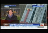
of kansas. as i take you back over to the graphic very quickly, fredricka, want to point out to you, tornado threat extend all the way from minnesota down towards texas. we have all these tornado watches in place until 11:00 tonight. >> wow. tornado warning from minnesota to texas but talking about -- >> watch. >> watch. okay. talking about a tornado emergency right now which means a tornado is on the ground in wichita, kansas. >> absolutely. >> thanks so much, jennifer. keep us posted on that. appreciate that. two days after a horrible accident in connecticut, railroad authorities are removing the broken rail cars from the site of that terrible crash. a commuter train derailed and struck another train in bridgeport. nine people were injured in the accident and remain hospitalized, one still in critical condition. susan candiotti joins us now live from bridgeport, connecticut where they've got a few things at hand here. you have people still recovering in the hospital. you've got the investigation of the crash itself. removal of debris, and the worry about tomorrow morning's
5:06 pm

commute. >> a lot of things to talk about here, fred. but let's boil it down to this. first of all, authorities and investigators both looking at the scene here were here throughout the night and day removing all the train cars from the tracks. that's a metro north train system. painstakingly removing them. two of the most damaged cars were taken to a special facility where investigators will be able to take a closer look at them. now we have this new development learning tonight more information coming to us from those plaque boxes that were recovered from the trains. we learned that both were going about 70 miles an hour, which we are told is normal speed for these trains at the time of the accident, when one derailed and the other plowed into a train going into the opposite direction. there was some braking just before that happened but they aren't sure at this time whether that's relevant to what caused the accident. they are also paying special attention to a piece of rail that had a fracture in it and
5:07 pm
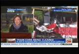
they're sending several hundred pounds' worth of that portion of the rail to ntsb labs in washington, again to take a closer look. the backdrop for all this now is what's going to happen to this rail system, because now they have to replace about 2,000 feet of track and overhaul the wires and the signal system and then test it and inspect it. so they are suggesting that could take days is all we know. therefore, commuters are being told to brace themselves because they are going to have to reroute themselves and they're going to have to pack a ton of patience at the same time because they're going to have to work around this area that's out of commission for now and they don't know how long all that's going to take. lot of people probably going to have to get on buses to work their way around the work that's going on here. fred? >> and that's one of the busiest commuter train systems right there in the northeast. what a mess it is going to be. all right, thanks so much, susan candiotti, appreciate that.
5:08 pm
looks like this week the white house is hoping it might be a better one. it is trying to shift focus now from scandals and controversy back to the president's agenda. will that plan work? coming up we'll talk to people who know all about scandal in the white house.

5:11 pm

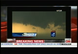
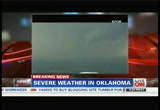
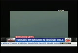
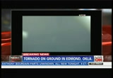
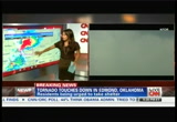
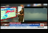
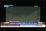
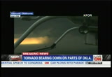
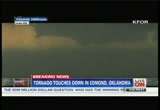
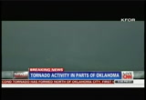
a tornado emergency in wichita, kansas. people are being urged as a result of that kind of ominous cloud activity that you're seeing in this screen. they're being urged to go underground, get to the basements, take cover, period. now this image right here is in oklahoma. we understand that entire midsection of the country really is under the threat of this incredible system that's making its way. let's listen in right now to what's being said on kfor. >> so you are west-northwest of downtown edmond. what direction are you looking for that wall cloud? >> i'm looking due south from my position in between western and santa fe, 2 1/2 miles west-northwest of edmond, 192nd street northwest. it turns into danforth road further east. >> reid, we tresh that. reid is highlighting this rapid circulation here. weather service has just reissued the tornado warning.
5:12 pm
has just reissued the tornado warning for northern oklahoma county and in particular edmond. low rapidly rotating wall cloud to his south. he's just west of downtown edmond looking down to his south. let's go back to john welsh and bob moore, chopper 4. >> right now let me tell you where we're at. i'm just over basically frontier city, we're shooting back to the west. the feeder band we've been talking about just continuing to get lower and lower. that's it. we'll pan back to the right, then sucking all that energy up and it is dropping it out right there. right -- look right on the left of your screen. that is definitely where there is a lot of rotation. we have -- it is right behind that rain. we got some rain right in front of it. as you see right there on your screen that is definitely some rotation, some clouds and they're probably 400, 500 feet lower than we are so they're probably now 700 feet above the ground. that's the area we are looking
5:13 pm
at. it is going to be about 122nd and let's just call it broadway extension -- just within that general area. so this is the next area of concern right here. as you can just see, the clouds are coming together. they're starting to rotate slightly and it's definitely forming. right before your eyes you can see -- we can't see the daylight. earlier we could see the color between there. it was almost like you just mix some ketchup and mustard together flp th together. that was the color of the sky. it was kind of odd. but you can see they're closing up and starting to rotate. that's pretty much north of 122nd just to the west of broadway extension. >> folks, the threat level is coming up. troy, coordinate with teesteve, with emily. we are getting more concern toward norman, south oklahoma city. bob moore, chopper 4.
5:14 pm
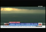
>> pretty threatening situation there in northern oklahoma county there where they are under a tornado warning. but right now under an imagine, a tornado situation. they call it a tornado emergency specifically where there is at least a report of one tornado on the ground. we are talking about wichita, kansas where people are being urged to go underground, get to those shelters or basements because the national weather service is using very strong language saying that is a potentially deadly tornado and you certainly don't wan to come face to face with it. so incredible tornadic activity taking place and threats of tornadic activity right there in the midsection of the country. jennifer delgado will join us momentarily on what to expect. it has been a rather stormy week for the president of the united states. could it be another rough week ahead? the president spoke at morehouse college's xecommencement today
5:15 pm
atlanta. he kept his comments focused on the economy and health care an didn't mention anything related to the reports of all those scandals. but can he move past them in the next week ahead? jack quinn, former white house counsel and karen tumulty is a water at "the washington post." jack, you worked with president clinton who was known for compartmentalizing issues. can this president do that as it relates to these controversies? >> yeah. i think in point of fact these controversies are really quite distinct and i think as time goes on they'll be handled on quite different tracks. a couple of these things are pretty serious. principally the irs issue. there is a lot to be answered to there. but as yet i haven't seen any evidence of high level wrongdoing at the treasury department, at the white house, or anywhere else. there's certainly been some
5:16 pm

incompetence that was clearly political targeting or targeting that had the effect of focusing on political groups. but that does not as yet appear to touch the white house, touch senior levels of the treasury department. there are a lot of questions there that have to be answered. in the scheme of things i thing that's the one that will have legs in terms of really draining the white house's attention and so on but it can be handled and managed and i think it will be. the others -- the ap issue is quite serious on its own account. benghazi, while serious, i really think there's no ability for the republican opposition to get any traction on that front in terms of pasting the white house. they already pasted susan rice. one thing we know now is that she was not at fault here at all and that the white house was neutral in terms of what was disclosed in those talking
5:17 pm

points immediately after the assault. >> in fact the president used the words "there's no "there" there" as pertains to at least one of those controversies. karen, what is it? when we look at the cnn/orc latest poll showing that the president's approval rating remains fairly high. it's actually increased a couple points even after the revelation of these controversies. what is it about his resilience that we're seeing? is it because the american public is saying that we don't see any real connection between some of these direct connections between some of these scandals and the white house? or is it because the president is saying i want to focus on other matters at hand, that greatly impact the american people? how do you see it? >> i do think you look at that exact same poll and you see that people, even as they are not holding the president responsible for this, they are taking each one of these controversies very seriously. the benghazi one primarily because they're worried not about talking points but about
5:18 pm

the safety of our diplomats overseas. but a week ago -- i mean nobody in washington knows as well as jack quinn does what it feels like to be in the white house and be getting a lot of this incoming. but unlike the clinton administration, which was dealing with it almost from day one, the obama administration has really been almost blessed to be spared this until now. so i do think it took them a while to kind of get their footing and a week ago at this time, president obama -- the irs allegations were out there and the white house essentially hadn't done much to get ahead of him. i think they have now taken a much more aggressive posture with all three of these. >> all right, jack quinn, karen tumulty -- real quick, jack, if you have a final thought. >> i think it is really important that the white house be clear about cooperating in these inquiries and i think it is important for the republicans not to fall into the trap of exaggerating or appearing to be
5:19 pm

partisan in these investigations. >> because that, too, canback fire. >> you bet it will. >> jack quinn, karen tumulty, thank you. we'll have much more on the tornadic activity in the midsection of the country when we come back. money, and i avoid frustration. you'll find reviews on home repair to healthcare written by people just like you. you want to be sure the money you're about to spend is money well spent. angie's list -- reviews you can trust. ♪ ♪ ♪ ♪ [ female announcer ] nothing gets you going quite like the power of quaker oats. today is going to be epic. quaker up.
5:20 pm
today is going to be epic. welwhere new york state is... investing one billion dollars to attract and grow business. where companies like geico are investing in technology & finance. welcome to the state where cutting taxes for business... is our business. welcome to the new buffalo. welcome to the new buffalo. welcome to the new buffalo. new york state is throwing out the old rule book to give your business a new edge, the edge you can only get in new york state. to grow our start your business, visit thenewny.com ...and we inspected his brakes for free. -free is good. -free is very good. [ male announcer ] now get 50% off brake pads and shoes at meineke.

5:22 pm

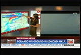
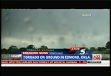
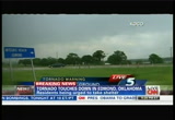
more on that tornadic activity specifically in wichita, kansas. we understand from the national weather service just moments ago that that tornado emergency, the tornado warning as a whole has actually been lifted. at first they had at least one tornado on the ground but that warning has been lifted. meantime what you are seeing right now are images. doesn't that look like a funnel of some sort that is forming. this is oklahoma. norman, oklahoma. edmond, oklahoma. sorry. let's listen in to kfor.
5:23 pm
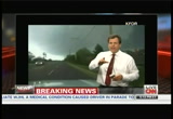
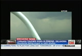
>> this is going to be about one mile to a mile and a half just west of i-35 at about 15th street. definite power flashes. you kind of still see the funnel right there. it might be difficult to pick up but it is moving pretty much straight east, northeast and just more power flashes right there. >> that is a tornado confirmed on the ground producing damage in edmond between 15th and 33rd and bryant avenues right now. it is on the ground. let's go back to reed timer in dominator 4. look at that. tornado on the ground in edmond right now. cone shaped ground on the ground in edmond. it's crossing bryant avenue right now. just north of 33rd and just south of 15th. it is on the ground right now. it is getting larger. it is getting larger. this is just to the northeast of oklahoma. it is heading for i-35 and 15th and 33rd. i think it will cross at 15th street. it is going to cross at 15th
5:24 pm
street and i-35 here in just about a minute. it is on the ground right now, heading for lake arcadia and it is heading for town of arcadia on route 66. go, reed. are you there? >> extraordinary images and talking point from our affiliate kfor. jennifer delgado here in our weather center, you can see that funnel we just heard the reporter and anchor talking about actually touching the ground right there in edmond, oklahoma, making its way toward lake arcadia and it looks like a pretty sizable tornado. sizable twister according to their perspective. >> absolutely. that's what we're look at. it is a cone shaped tornado. this is the time of the year that we start to see this. you can also start to see more of the rotational lowering of the cloud as we go on. of course this is certainly a life threatening situation
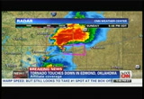
5:25 pm
across parts of edmond. we're going to continue to see things like this happening through parts of oklahoma as well as kansas as we go through really about the next couple hours. looks like the tornado on the ground. we do have the warning. it is in place until 4:45. this is in that northern part of oklahoma city. as we take you over to our graphic here we see the video. now we want to help you visualize what's happening on the radar. here is edmond. there's our rotation. looks like we have two signatures and that's what we call our tvs. we are going to track this storm for you so you can get an idea where this storm is headed and the time. there is the red signature there, tvs. this is at 5:24. this is eastern time. let's track this for you. we put this into motion. hopefully our producers back there can track this for you you and pull up some of the times of where we are potentially see this storm at the northeast-northeast at roughly 30 miles per hour. i am going to pop out of this just for a second.
5:26 pm
what we've been seeing out of oklahoma as well as what we've been seeing out of kansas, these storms been these super cells are going to continue and you can also see if we look on the radar where this inflow is. this is enmondadmond, the city. if you're in luther you need to watch out for this storm as it crosses over interstate 44 and as we continue to follow what's happening i think this is coming out of kfor out of edmond. this is oklahoma city. but certainly dangerous situation. it is going to continue to be vial lolent as we go through th evening hours. it will continue to peak as we go through about 8:00 this evening. >> we reported the tornado emergency was lifted in wichita, kansas, but that necessarily mean the folks in kansas are out of the woods? >> absolutely not. we are talking tornado watches in place from areas from minnesota all the way down to texas until 11:00 at night. if we go to the graphic, you can see where we are talking about areas in red. for oklahoma, as well as into areas like kansas, these are the
5:27 pm
areas that are really going to be our greatest concern even in that northeastern -- or i should say northwestern part of missouri we are talking st. joseph, kansas city, all these areas are very highly populated so you want to make sure you have that storm shelter or a basement, get to the lowest part of your home. >> highly populated right here in this edmond, oklahoma. as we look at these images, when you saw a tighter shot of the funnel cloud, you also saw debris flying in the air. we heard the anchor and reporter talking about how it already passed the 15th street area over to i-35 making its way to lake arcadi arcadia. then in the tight u you saw pieces of what appear to be debris. it is clearly causing some damage. >> we can see that debris at times on the radar. that's an indication of how strong these storms can be. i think we're waiting for the helicopter -- this is so dangerous out there for these people covering these storms. we were looking at something earlier. all these storm spotters are all
5:28 pm
in place across parts of oklahoma, as well as kansas and they are really putting their lives at risk but they know how to follow these storms and get out of the way. >> even in this area, this tornado alley -- right there. >> there is our debris right there. you can see it kicking up. that's a strong cone shaped tornado and that's -- i can't tell exactly where that's coming out of. that's out of edmond as well. gets confusing out of oklahoma and kansas at these hours. >> right now, edmond, oklahoma. >> moving into the area east of i-35 towards air depot. in a treated area, i don't know. i know there are some houses over there but it is moving -- looks pretty much due east. >> i'm actually looking at the radar right now and not only are we getting hail but we're seeing this tornado kicking up debris. if you live in arcadia you need to take shelter right now. this storm is moving to the east. arcadia, take shelter right now. we've got significant debris. i just got hid up side the side
5:29 pm
by some quarter sized hail that's been coming down. significant tornado here with debris coming up. >> so those along arcadia lake there, right along route 66, if you live along route 66 there near arcadia lake, talking about areas down near pops. anyone within that area you need to go into your tornado shelter immediately. again you are looking at live video right now of a tornado there on the ground. that's now east of i-35 moving at about 30 miles per hour there. once again we continue to watch this tornado. this looks like it is going through phases here where it wraps up, then it comes down, then wraps up once again. let's go over to an advantage doppler hd so we can show the velocity. this is going to be route 66. here's midwest boulevard. air depot. the rotation is going to be tightening --
5:30 pm
>> wow, incredible. you were seeing the flying debris there. we're getting images from koco as well as kfor out of edmond, oklahoma. you heard the reporters talking about the path of this tornado that has touched ground. you have seen the images of that funnel cloud. you've seen the debris that has been dispersed as well. moving 30 miles an hour toward arcadia. >> what we're seeing is a storm system -- again the one that's producing this tornado, it is moving to the east. roughly about 30 miles per hour. anywhere to the east of interstate 44 in and luther they're going to see potentially the storm if it holds itself together potentially bringing it with the tornado threat. as we go over to some of the live video you kind of see exactly why they're so worried here. we are starting to see those tornadoes popping up and
5:31 pm
lowering as well as better rotation. as i take you back over to our radar here, hopefully we can track this a bit more for you. you mentioned luther. we are talking arrival potential if the storm holds together by 5:19. again that's central time but for arcadia as well as into luther, these are our tvs signatures. there is our class ig signature right there as it moves across interstate 44. this is very close to oklahoma city and when we see these tornado popping up these like super cells, make sure you have a basement. get into the lower part of your home an of course if you have an interior area, go to that as well. if you have a helmet, and there is a tornado, put it on. if you're in the bathtub, pull in a mattress or something to give you that extra protection. this is something we see very often across parts of oklahoma and kansas for this time of year. this is the peak season and we're actually running below
5:32 pm
average. typically we see 322 for the month of may. i think roughly the count right now, we're probably at about 30 to maybe 35. running behind the average but it looks like we're picking up with the action. >> wow. is an area that's used to handling and living through, enduring tornadoes. >> this is tornado alley. >> they usually have a plan, whether it be in the bathtub or be in that guest bathroom. anything that has four walls, away from doors, away from windows. everyone knows to do that but every now and then someone is new to the area and doesn't know and this kind of instruction you are giving is really very important for survival. >> absolutely. we do know as we pulled some more information on our tornado warning, people affected, we are talking more than 4,000 people affected in the path potentially of this super cell moving over towards the east. that includes luther as well as into areas just right along edmond, as well as into that region. >> so from oklahoma -- >> kansas. >> kansas. minnesota. all these areas now dealing with a tornado watch.
5:33 pm
we also want to focus on what's happening across parts of oklahoma and kansas but keep in mind, this threat is going to be pretty great for many air yadz and you can see the tornado watch in place. for many of these areas this is going to last until 11:00 tonight. that's all the way down to areas including that very northeastern part of texas. we are all thinking about what's happening in texas as they recover and they pick up the pieces from those tornadoes that popped up to the southwest of dallas. but again you see this line. it is really going to be developing moving through kansas city especially as we get to about 9:00. again we are continuing to see more of those clouds lowering and more rotation coming up. >> oh, my goodness. that appears to be another funnel that's forming right there. almost in the middle of your screen just barely to the right there. as you watch it kind of -- >> you see it lowering, that roping going down. >> makes its way like forming a little tail. >> absolutely. this is the lowering. we saw video earlier of that debris that was spinning around. this is something that we're going to continue to see.
5:34 pm
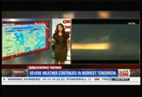
of course we talked about that tornado emergency earlier out of wichita. we still don't have any information what's come out of there, possible damage of that very large tornado that was spotted. >> jennifer, help us understand how it is that this happens. it is a confluence of cold air, hot air -- >> we have a clash of air masses. they just don't merge well together. what we're seeing is basically for areas, including oklahoma, into kansas as well as into texas we have this dry line. that helps trigger things as well. that's why we're talking about the greatest risk for tornado. it is going to be across that part of kansas and oklahoma where we see these storms firing up. as i take you over to our graphic very quickly, we talked about the tornado watches in place until 11:00 tonight. this is the area. we've been talking about this all afternoon, fredricka, the area of concern. now we are seeing it for wichita, as well as into oklahoma city. the national weather service, they all said this is going to be the greatest area of concern and we were thinking the same thing and it is all playing out. forecast is verifying. as we go through today,
5:35 pm
tomorrow, even into tuesday we're going to continue to see more of these storms producing tornadoes as well as damaging wind and large hail. of course you know large hail can be deadly as well. this gives you the threat as we go sunday as well as into monday. again more video coming -- live shots coming out of oklahoma city. >> when we talk about the prelude to a twister, the hail, the cooling of the air -- >> we have a strong front coming through. >> a lot of people who are survivors of tornadoes talk about the feeling of trying to open the door but there was like a sucking kind of sensation and realizing that there was something very nearby in the form of a twister that had changed the atmosphere. >> we just saw some video of cars actually below it. lot of people they think, maybe i'll go hide underneath or take shelter under an overpass. that's bad because sometimes you get that air evacuating and that can be even more dangerous when you get under these overpasses. >> incredible. again, we are talking about this storm as we heard the local
5:36 pm
reporters there on the ground talking about it making its way toward i-35 there at edmond, oklahoma, as well as not only just touching down in that city of edmond, oklahoma but threatening arcadia as well and luther not far off. i think you had mentioned, jennifer, that maybe luther might be in the crosshairs in under an hour or so from now? >> yeah. actually we're trying to pull that back up. i think we said 5:19. you can see those clouds lowering. you see the rain shaft over there. when we see these tornadoes coming through and they can be so large, sometimes they can be masked by the rain. we talk about rain-wrapped tornado. we're hopefully going to pull up the track for you but until we do we'll go back over to our weather graphics. we talked about some of the areas that are going to be under the gun today as well as tomorrow but that's looking even more impressive an even more dangerous. we do have that tornado warning i think in place until 5:15 local time. maybe we can get that
5:37 pm
information -- 4:45. i'm sorry. that includes northern oklahoma county. this is near oklahoma city, and we're going to continue to see more of that debris but the clouds continue to lower looking even more basically dangerous and deadly. >> they're getting serious rain bands as well. this is a wet system with also high winds and a changing of direction seemingly just from these live shots of the twisters that seem to be forming. they just seem to be dancing around the screen as we see them form. >> that's it. it is a dance and it is not a dance you want to be invited to, fredricka. shrewdly. all right, now as it pertains to kansas that we mentioned earlier, wichita, that emergency has been lifted so overall, it means that the tornado warning has been lifted for that area as we look at edmond, oklahoma? >> yeah, absolutely. for kansas. we talked about this earlier where the national weather service employees were located
5:38 pm
in wichita. basically they saw this storm coming through. they knew that this was a large and dangerous tornado. they had to basically give up their duties and turn them over to topeka because they had this tornado coming through. they had to get underground and they had to take shelter because this was "a deadly" tornado and they were expecting possibly widespread destruction. again you are looking at this tornado and you are looking at the down draft coming down there. what you're looking at as we go back over to our radar, we are tracking this for you. this again we are talking about that very classic signature. you continue to see more of these tvss, and i think we'll see more live video out of edmond of these tornadoes lowering. but want to point out as we track this for you you, we talked about luther and we do know -- i think that population roughly is about 4,000. it is going to arrive in falice at 5:33 central time. is it 4:38? we still have about another hour, then we still have that
5:39 pm
tornado warning in place until 4:45. >> kfor, which is providing a lot of these images there on the right of the screen. is also reporting these tornado watches remain at least in effect in central and the eastern portion of oklahoma, and that there remains a severe threat right into monday. so while i know we've been reporting this watch from minnesota to texas in place until about 11:00 p.m., folks here in this area in edmond, oklahoma and in that general vicinity are really preparing themselves for the long haul over the evening, into monday. >> that's right. absolutely. we're going to continue, as i said, for this threat to spread to areas, including more populated areas like kansas city, as well as into st. louis, even potentially into chicago. now as we go back over to our graphics and we focus a bit more, we talked so much about the tornado watches being in place until 11:00 for areas from minnesota all the way down towards texas. you expect that out of texas. you expect that out of oklahoma but you don't think of minnesota
5:40 pm
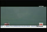
but in fact parts of minnesota are a part of tornado alley. as we go through today, tonight, we're talking large hail, damaging winds and again tornado are going to be likely but it is not just sunday. we're going to add in for monday as well and you notice for areas as we cross over the lake, you can see milwaukee, chicago, even into parts of areas including michigan. and this includes st. louis, kansas city, we're talking millions of people are potentially going to be affected by the severe weather. now in addition to the tornadoes of course, keep in mind some of these strong straight-line winds can do just as much damage and of course can be deadly as well. now the other area that we've been following of course, parts of the southeast. we've been looking at some very heavy rainfall, storms moving through as well. that's separate. that's flash flooding and that's been happening across parts of georgia where some of these locations have actually picked up about six inches of rainfall overnight. >> my goodness. look at the image now, jennifer. look how dark it has gotten just
5:41 pm
in the minutes that you've been talking. there's kind of that ketchup-mustard mix in the sky that we heard one of the reporters describing that he saw earlier and now kind of that's revisited. but in general it is very dark there. again it is the 4:00 hour local time there and on the horizon you still can see the rain bands and potentially the twisting of the -- the rotation. >> it is hard to tell right now exactly what's going on there. of course, yeah, we're seeing the down draft. we've seen over the last hour numerous tornadoes just lowering and the rotation of the clouds. >> extraordinary. and all this coming on the heels of what has been a fairly docile season. most of the activity usually happens early in may. now here we are -- we're still kind of mid toward the end of may and suddenly the activity's picking up. >> it is. that appears to be that rain
5:42 pm
wrapped. that's why we are having a hard time seeing it with the darkness to the right of the screen as i look a little bit more past the helicopter. >> very good. jennifer delgado, thanks so much. we'll let do you some extra checking and we're also going to be checking in to our reporters and our affiliates there in the edmond, oklahoma area and beyond and we'll get right back to it right after this. we had never used a contractor before and didn't know where to start. at angie's list, you'll find reviews on everything from home repair to healthcare written by people just like you. no company can pay to be on angie's list, so you can trust what you're reading. angie's list is like having thousands of close neighbors where i can go ask for personal recommendations. that's the idea. before you have any work done, check angie's list. from roofers to plumbers to dentists and more, angie's list -- reviews you can trust. i love you, angie. sorry, honey. made a retirement plan, they considered all her assets, even those held elsewhere, giving her the confidence to pursue all her goals.
5:43 pm

when you want a financial advisor who sees the whole picture, turn to us. wells fargo advisors. twenty-five thousand mornings, give or take, is all we humans get. we spend them on treadmills. we spend them in traffic. and if we get lucky, really lucky, it dawns on us to go spend them in a world where a simple sunrise can still be magic. twenty-five thousand mornings. make sure some of them are pure michigan. your trip begins at michigan.org.
5:44 pm

all stations come over to mithis is for real this time. step seven point two one two. verify and lock. command is locked. five seconds. three, two, one. standing by for capture. the most innovative software on the planet... dragon is captured. is connecting today's leading companies to places beyond it. siemens. answers.
5:45 pm

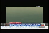
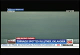
much more on the severe weather we're watching. incredible live images of the ominous activity taking place right now in edmond, oklahoma. take a look at these images right here just in the last 30 minutes or so we've seen a number of funnel clouds forming. we heard from some of the reporters they'd even touched ground in edmond, oklahoma then making its way toward i-35 in the arcadia area, then threatening luther as well. it is too early to tell what kind of damage has been done here but we know from this activity, we've seen a lot of debris flying. are you looking at live images from our affiliate kfor. right now very dark. it is the 4:00 hour there. local time in edmond, oklahoma. people have been warned that because of this tornado emergency they need to take cover. they need to be in the basements. they need to be in their storm shelters. the roads.
5:46 pm
a lot of hail activity has been reported as well. we're getting new information right now in luther, oklahoma from our affiliate koco that a tornado is on the ground there. no confirmation but that indication coming from our affiliate koco, a tornado, twitter, twit twitter on the ground in luther, oklahoma. jennifer delgado's been talking about the track of the storm and luther's likely been in the crosshairs next. already they're seeing some tornadic activity there. this threat remains in effect not just in oklahoma but we're talking about this system spanning from minnesota all the way to texas and the tornadic or the threats of tornadic activity is in place until 11:00 at night. however, places like oklahoma and even in nearby wichita, kansas, which also experienced at least a report of one tornado
5:47 pm
on the ground, they are maintaining a situation where they are looking at potential activity throughout the evening and you're seeing right there kind of the rotation of cloud or at least a dusting up. very difficult to tell there whether that is indeed a twister that is forming. it appears as though there is an incredible rotation that you are witnessing live right now from this chopper shot, kfor. this is tornado alley. the folks there in this area are used to enduring an living through tornadic activity. but this is a very dangerous situation even for this local affiliate tornado. but they know to try to keep a certain distance because they are at the mercy of that kind of pull that comes with the rotation of these cloud as well as the debris that may be kicked up as a result of twisters hitting the ground. let's listen in to their live coverage and what they are reporting now. you sthee fieee that field of d
5:48 pm
with this live shot, tornadic activity in edmond, oklahoma. let's listen in to kfor. >> it is about on krocovell roa. covell road. zoom in right there. can you guys see our signal, mike? all right, i'm going to come to the right. >> it lks like we lost that signal there. we talked about them being dangerously close to that kind of rotation. we'll find out if that indeed impacted their live shot. meantime we're also watching the live coverage of our affiliate
5:49 pm
koco. they've been talking about the tornadic activity right there in oklahoma an all that's taking place. you see their live images right there. >> they appear to be thinning very, very fast. >> absolutely there. and you're probably going to see more debris coming through. a lot of us know as you go east of i-35 the amount of tree density begins to increase. you'll probably see trees get kick up there. again you can see right along, looks like there's going to be a creek there known as deep fork. that's going to be just north of route 66, north luther road. right around peebley road there. >> these are the cities we are talking about. talking about edmond, oklahoma. arcadia and luther, oklahoma. all in the paths of this activity where we've seen these ominous clouds. they've gone from dark gray to near black and then a formation of twisters. as you see right there, that kicking
5:50 pm
you can see power lines snapping there. let's take a look and a listen to what's taking place. >> man, look at all of that power flashes. yeah. >> is it going to hit it? look. it's fixing to hit this house. the house is -- look at the house. holy cow. >> man, it's coming up on a handful of houses right here. i'm fixing to break free. stay on it. i've got to break. hey, mike, we're having to break
5:51 pm
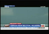
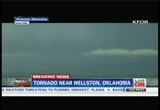
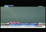
free about half a mile from. it's moving pretty quick. i'm on oak park road, and just south of, like, the stillwater central, the train tracks right there. we're just coming up on arrowhead and county road 3310 and we've already saw this thing take out two or three houses. a ton of power flashes, and it's moving pretty quick, and i'm almost into the town. it's right up my nose. if you're in wellston you need to be in your tornado shelter already. this is tracking towards town and definitely a lot of energy. i'm going to spin the helicopter again and wield hold right here give you a better shot, but it's on the ground, and it's about, let me get around here, about a mile and a half, a mile and three quarters, right to the west of me, and i'm trying to zoom out of my map here. i don't have the county road,
5:52 pm
but itting w it looks like it w track north of wellston. you can see the funnel cloud, wall cloud. it's actually lower. you've got a big, wide funnel there and this thing is grinding up the ground as it transitions to the east, mike. >> there it is. >> there it is. and it looks like -- it looks like it's actually growing, maybe, a little bit. if i get this dang gone skid out of the way, we can zoom in there. wep have t we have the lowering right there, and it almost appears -- it almost appears it might be kind of roping out a little bit at this time. i'm going to have to break free and kind of get a little bit to the east, as it continues to move on us. if you're in wellston, you need to be in your tornado shelter, tornado-safe area, because this is coming right toward town. it's probably about three miles, 3 1/2 miles to west of it now and directly eastbound, mike.
5:53 pm
you think it is? all right. if you're just joining us, an extraordinary moment. we're looking at at least one twister that has formed there. it is touching the ground. this in wellston, oklahoma. this after we've been watching for the last 30 minutes or so live activity. thanks to our affiliate and this chopper shot kfor. we've seen tornadoes, at least one tornado touch down in each of the cities of edmond in arcadia, in luther and now in
5:54 pm
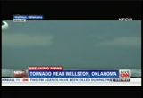
wellston, oklahoma, and an extraordinary sight, not only were we seeing the flashing from power lines that were being hit, but, according to this chopper reporter, he counted about two to three houses that were simply decimated by this tornado, and, again, now you're seeing a more defined view of this funnel cloud, and you see the sparks there, power line, and it hitting anything in its path. this is a monster of the storm system. we've boon hearing from jennifer delgado who said millionless be affected by this storm system, because it is spanning from texas all wait to minnesota. over the next set of hours. up until at least 11:00 p.m. tonight and possibly overnight. folks in nearby kansas are warning residents there to expect a lot more severe weather, even into monday. but right now, again, extraordinary live images of a monster of a tornado, it appears, touching gound there in wellston, oklahoma. we've been listening to
5:55 pm
incredible reporting there from the chopper of a reporter there as well as anchors and reporters in other locations in this oklahoma area. let's listen in to what they're saying now. >> -- just to the north of it. i wouldn't push it with this thing. it's already torn up two or three houses. i'm directly over the town of wellston right now, and it looks like it's going to be about a mile and a half just north of me. if you're in the town of wellston, i think you're going to be clear, but unless this thing really continues to grind and turn more to the south easterly direction, but -- this thing is -- it's definitely increasing. it is tearing up everything in its path, and there's sporadic homes out here on anchorage. so if you live, like, i don't know, two miles north of wellston, along that easterly west track, you're derchtly going to want to be in a tornado shelter here. this tornado is probably a half mile wide now. it's continuing to grow. you can see the feeder band
5:56 pm
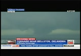
lowering right on the left side of the screen. we've got very, very intense lightning right behind me, and this is just becoming a grinder here, and as it continues to come straight to the east. >> dude that thing is freakin' huge. >> that is a monster of a tornado if you're looking at it live right now touching ground. you heard from that chopper reporter. his chopper's only an a half mile by his estimation away from that twister in his words is tearing up everything. awe saw power lines sfla s snap to three houses simply decimated. as we've been watching these funnel clouds form and touch ground, this one by far just
5:57 pm
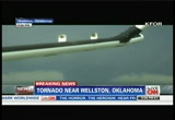
within the past 35, 40 minutes now is by far the widest, the largest. he says by his estimations, a reporter and chopper there, about a half mile wide. this tornado. let's listen in on what he's saying right now. >> destroyed the wellston -- it's headed almost directly from chandler. if you took a dot, put a line on chandler and went straight, 2-7-0 straight west, that's where the storm is. counteder road 33407 and like 890. doesn't tell you much. but northeast of wellston shooting this storm, and this tornado's continuing to grow, there's sporadic homes out here on acreage that are in the path. like you said earlier, if you're in a bathroom a closet, you need to get under ground, because this storm is growing, and it is just ripping everything up in its sight. mike?
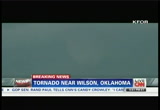
5:58 pm
>> i'm going to descend top get a better perspective here. i mean, several -- >> yeah. i'm going to be just northeast of wilson. >> so if you're just now joining us, again, you're looking at live tornadic activity right now in oklahoma. kniss is wellston, oklahoma. our affiliate kfor bringing us extraordinary live images from their chopper. the chopper reporter says they're only about a half mile away from this chopper as he is also dancing around to make sure
5:59 pm
that he is out of harm's way, but it's a very wide storm, a wide funnel cloud by his estimation, about a half mile wide, and while we've been on the air taking this live shot, we have seen the sparks flying from power lines that have been wiped out, and we also saw a field of debris. two houses, maybe even three, perhaps even more according to this reporter have been simply wiped out. an extraordinary scene here in really what is kind of the dinner hour on sunday there in oklahoma. the threat isn't over. all in that area, being asked to really take cover. go to the basements. go to their tornado safe places. this is tornado alley. they're used to dealing with things like this, however, this is a monster of a storm. a quiet may, usual lly peak for this kind of activity. it's the end of the month and things are starting to pick up. i'm fredricka whitel
123 Views
IN COLLECTIONS
CNN Television Archive
  Television Archive News Search Service
Uploaded by TV Archive on
